712 Digital Group - top

KJAN Weather

Local Radar

Monthly Local Weather Information:
January May September
February June October
March July November
April August December


View Weather Announcements

NWS Forecast for Cass & area Counties: Fri., Aug. 24th 2012

Weather

August 24th, 2012 by Ric Hanson

346 AM CDT FRI AUG 24 2012- National Weather Service/Des Moines

TODAY…PARTLY SUNNY. ISOLATED THUNDERSTORMS BEFORE NOON. ISOLATED   THUNDERSTORMS LATE IN THE AFTERNOON. HIGH IN THE UPPER 80S. SOUTH WIND 10 TO 15 MPH. CHANCE OF THUNDERSTORMS 20 PERCENT.

TONIGHT…MOSTLY CLOUDY. A CHANCE OF THUNDERSTORMS THROUGH MIDNIGHT…THEN SHOWERS LIKELY AND SCATTERED THUNDERSTORMS AFTER MIDNIGHT. LOW IN THE MID 60S. SOUTH WIND 5 TO 10 MPH. CHANCE OF PRECIPITATION 70 PERCENT.

SATURDAY…SHOWERS AND SCATTERED THUNDERSTORMS. COOLER. HIGH IN THE MID 70S. SOUTH WIND 5 TO 10 MPH. CHANCE OF PRECIPITATION 90 PERCENT.

SATURDAY NIGHT…SHOWERS LIKELY AND SCATTERED THUNDERSTORMS. LOW IN THE MID 60S. SOUTHEAST WIND NEAR 5 MPH. CHANCE OF PRECIPITATION 70 PERCENT.

SUNDAY…MOSTLY CLOUDY IN THE MORNING THEN BECOMING MOSTLY SUNNY. A 30 PERCENT CHANCE OF THUNDERSTORMS. HIGH IN THE LOWER 80S. NORTHEAST WIND NEAR 5 MPH.

SUNDAY NIGHT…PARTLY CLOUDY. LOW IN THE LOWER 60S.

MONDAY THROUGH WEDNESDAY…MOSTLY CLEAR. HIGH IN THE UPPER 80S. LOWS IN THE MID 60S.

Climatologist says drought not over yet

Ag/Outdoor, News, Weather

August 24th, 2012 by Ric Hanson

Iowa State University climatologist Elwyn Taylor says the cooler temperatures and rainfall we’ve seen recently do not mean Iowa’s drought is finished. “It definitely has not broken yet, maybe has for a few locations, but for the most part it is still with us,” Taylor says. Some areas of the country though have seen the relief from dry conditions come. “The southeastern United States is done with their drought, Texas, New Mexico, Arizona — we won’t say done with the drought– but much moderated there and disappearing in places but still at strength in the Midwest and out into the Rocky Mountains,” according to Taylor.

Taylor says about 80-percent of Iowa’s rainfall comes from the Gulf of Mexico.  “We are seeing a flow of moisture, at least a moderate flow of moisture from the Gulf of Mexico,”Taylor says, “and it’s only about half the strength, or a little less than half the strength, and with that being weak we’re not seeing a real quick end to this”. While Taylor says factors influencing Iowa’s weather are moderating toward more normal temperatures and moisture in the immediate future, he expects the drought to continue into next spring in most areas.

(Radio Iowa)

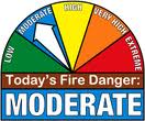
Shelby County Fire Danger back to the “HIGH” category today

Ag/Outdoor, News, Weather

August 23rd, 2012 by Ric Hanson

A slight improvement in the atmospheric moisture content has prompted the Shelby County Emergency Management Agency to reduce the Fire Danger index from “Extreme” to “High,” where it had been for several weeks prior to Wednesday’s extremely dry and dangerous conditions. Shelby County Emergency Management Coordinator Bob Seivert says thunderstorms are in the forecast for the next few days and hopefully, some of that rain will fall over Shelby County.

Seivert is asking participating agencies in the County to move their “Fire Danger” signs back into the High Category. He says while the explosive conditions the area experienced Wednesday have moved on, the wind this (Thursday) afternoon and Friday are expected to increase into the 20-mph range.

Open burning is not recommended.  Please call the emergency management Agency at 755-2124 if you feel you need to burn during this time.

Drought intensifies in key farming states

Ag/Outdoor, News, Weather

August 23rd, 2012 by Ric Hanson

ST. LOUIS (AP) – The latest update on the nation’s drought shows that the parched conditions continue worsening in key farm states even as the situation across all of the continental U.S. leveled off.  The weekly U.S. Drought Monitor map shows that more than two-thirds of Iowa, the nation’s biggest corn producer, was suffering extreme or exceptional drought – the worst two classifications – as of Tuesday. That’s up more than 5 percentage points from last week, despite cooler temperatures.  Nearly all of Nebraska and Missouri are in extreme or exceptional drought, narrowly ahead of Illinois and Kansas in those two categories. The amount of Nebraska afflicted with exceptional drought conditions – the most-serious level – remained unchanged while dropping only slightly in Illinois.

August could end long streak of warmer than normal weather

News, Weather

August 23rd, 2012 by Ric Hanson

Despite the warmer temperatures Wednesday, State Climatologist Harry Hillaker says August could break up a 10-month long streak in Iowa. Temperatures in August have averaged roughly two-and-a-half degrees cooler than normal. “Chances are fairly good we’ll end the month with below average temperatures, despite warmer weather off and on the next week or two,” Hillaker said. The cooler-than-normal trend in August is a drastic change from July – which entered the record books as the fourth warmest month, on average, in Iowa history. “We haven’t had a month averaging below normal dating all the way back to September 2011 and many of those months were quite a bit above normal” Hillaker said. “This has been quite a change from what we’ve been seeing.”

In July, the capital city of Des Moines recorded 10 days with a high temperature of at least 100 degrees. In August, there have been five days where multiple cities have posted record low temperatures. “Part of that is related to the fact that it’s just so darn dry,” Hillaker said. “We have very low humidity, which allows air to cool off much more at night than it would otherwise and that makes it easier to get unusually low temperatures.”

Iowa has posted nine consecutive weeks with below normal precipitation. There have been some unusual single day temperature swings in August as well. For example, on Tuesday, Hillaker said Mason City hit a low of 41 in the morning before warming up to 81 in the afternoon. Here in Atlantic, our 24-hour low Wednesday was 52. The thermometer darted up to 95 during the afternoon. That was just 5-degrees shy of tying the record High for August 22nd.

(Podcast) Weather Forecast – Thu., Aug. 23rd 2012

Podcasts, Weather

August 23rd, 2012 by Ric Hanson

The Skyscan (Podcast) forecast from Freese-Notis for the KJAN listening area, and weather data for Atlantic….

Play

NWS Forecast for Cass & area Counties in Iowa: Thu., Aug. 23rd 2012

Weather

August 23rd, 2012 by Ric Hanson

344 AM CDT THU AUG 23 2012

TODAY…MOSTLY SUNNY. BREEZY. HIGH IN THE LOWER 90S. SOUTH WIND 10 TO 20 MPH WITH GUSTS TO AROUND 30 MPH.

TONIGHT…MOSTLY CLOUDY. A SLIGHT CHANCE OF THUNDERSTORMS THROUGH MIDNIGHT…THEN A CHANCE OF THUNDERSTORMS AFTER MIDNIGHT. LOW IN THE MID 60S. SOUTH WIND 5 TO 15 MPH. CHANCE OF THUNDERSTORMS 30 PERCENT.

FRIDAY…MOSTLY CLOUDY. HIGH IN THE MID 80S. SOUTH WIND 5 TO 15 MPH.

FRIDAY NIGHT…MOSTLY CLOUDY. A SLIGHT CHANCE OF THUNDERSTORMS THROUGH MIDNIGHT…THEN A CHANCE OF THUNDERSTORMS AFTER MIDNIGHT. LOW IN THE MID 60S. SOUTH WIND 10 TO 15 MPH. CHANCE OF THUNDERSTORMS 30 PERCENT.

SATURDAY…THUNDERSTORMS LIKELY. HIGH IN THE UPPER 70S. SOUTH WIND 5 TO 15 MPH. CHANCE OF THUNDERSTORMS 70 PERCENT.

SATURDAY NIGHT…CLOUDY WITH A 50 PERCENT CHANCE OF THUNDERSTORMS. LOW IN THE MID 60S.

SUNDAY…MOSTLY CLOUDY WITH A 40 PERCENT CHANCE OF THUNDERSTORMS. HIGH AROUND 80.

Emergency Mgmt. Officials warn of dangerous fire conditions today

Ag/Outdoor, News, Weather

August 22nd, 2012 by Ric Hanson

The Shelby County Emergency Management Agency is telling residents of the county that outdoor burning will not be permitted AT ALL, today. The County is one of several in far western Iowa to be placed under a “Red Flag Warning” for this afternoon and this evening. The warning is in effect from Noon until 7-p.m.  Emergency Management Coordinator Bob Seivert said all Fire Danger indicators will be in the “Extreme” category this afternoon, because any fires that do develop, can move rapidly. He say the amount of “fuel” in the fields and the dry conditions indicate that if fires do develop, they could move into communities, much like they have in the western states of Colorado, Nebraska, and to our south, in Oklahoma.

The county has been in the “High” Fire Danger category for several weeks now, and  Sievert says citizens have been very mindful of the dangers and cooperative. He says his agency has had a lot of cooperation from the public in calling in their need to burn, and connecting them with their local fire chief so they can conduct a burn safely. Seivert encourages people who want to burn – not today, as no burning is allowed – in the future, to call 755-2124 so that officials can ensure the burn is safe and conducted according to standards.

Seivert says officials in Shelby County began preparing for today’s Extreme Fire Danger threat, Tuesday night. He says meeting have taken place with the fire chiefs and fire officers in Shelby and surrounding Counties, as well as elected officials. The parameters that exist today and how they differ from other fire emergencies were outlined during those sessions. Seivert warns of what could happen if a fire does develop during the extremely dry, and windy conditions that are expected today. He says they may be asking citizens to leave their homes and move to a safer location, to get them out of harms way.”

Cass County is not included in a Red Flag warning. Instead we are in an “Enhanced Fire Danger” category. Cass County Emergency Manager Mike Kennon told the Board of Supervisors during their meeting this morning, that citizens here need to be wary of the danger faced by fast growing fires, as well. He says you should refrain from outdoor burning, and issued a reminder the County is and has been under a Burn Ban for quite some time. Kennon says Montgomery County Emergency Management Coordinator Brian Hamman is using a Wildland Fire Dispatch procedures. That means if there’s a grass fire, neighboring fire stations will be dispatched for mutual aid. That includes those from communities in the southern part of Cass County.

(Podcast) Skyscan Forecast: Wed., Aug. 22nd, 2012

Podcasts, Weather

August 22nd, 2012 by Ric Hanson

The Freese-Notis (podcast) forecast for Atlantic & the KJAN listening area.

Play

RED FLAG WARNING for the western 1/4 of Iowa

News, Weather

August 22nd, 2012 by Ric Hanson

MONONA-HARRISON-SHELBY-POTTAWATTAMIE-MILLS-MONTGOMERY-FREMONT AND PAGE COUNTIES

THE NATIONAL WEATHER SERVICE IN OMAHA/VALLEY HAS ISSUED A RED FLAG WARNING WHICH IS IN EFFECT FROM NOON TODAY TO 7 PM CDT THIS EVENING.

SOUTHERLY WINDS GUSTING TO AROUND 25 MPH ARE EXPECTED FROM LATE MORNING THROUGH THIS AFTERNOON. THE RELATIVE HUMIDITY WILL FALL TO 15 TO 20 PERCENT THIS AFTERNOON. NO THUNDERSTORMS ARE EXPECTED AT THIS TIME. ANY FIRES THAT DEVELOP MAY SPREAD RAPIDLY. OUTDOOR BURNING IS NOT RECOMMENDED.

PRECAUTIONARY/PREPAREDNESS ACTIONS…

A RED FLAG WARNING MEANS THAT CRITICAL FIRE WEATHER CONDITIONS ARE EITHER OCCURRING NOW…OR WILL SHORTLY. A COMBINATION OF STRONG WINDS…LOW RELATIVE HUMIDITY…AND WARM TEMPERATURES WILL CREATE EXPLOSIVE FIRE GROWTH POTENTIAL.