
(Radio Iowa) – While there have been scattered showers, parts of Iowa have had very little rain since mid-summer and the continued dry weather is drawing down soil moisture levels. State climatologist Justin Glisan says while drought conditions are lessening in some areas, they’re worsening elsewhere, as much of Iowa’s western third is now in moderate to severe drought. “Subsoil conditions across much of the region show a below-normal percentile,” Glisan says. “Recent warm and windy days produced higher evaporate demand in the atmosphere, so the atmosphere is thirsty, especially for this time of year, those conditions allow for extraction of any subsoil moisture or surface moisture that we see.”
We’re heading into a drier time of year, so Glisan says it will be difficult to recharge soil moisture levels before spring. “With a lack of precipitation, this makes rainfall infiltration when we do get it harder to get down deep,” he says. Glisan says that lack of soil moisture may bring some help to Iowa’s farmers in the spring. “The silver lining here is that moving into the growing season, drier-than-normal conditions will make field work and planting easier,” Glisan says. “If you go back, the last two or three years, we’ve had pretty wet conditions going into the growing season with record subsoil moisture which delayed planting.”
Conditions could change within a matter of several weeks, as Glisan says the trends point to above-normal precipitation for January through March.
(Radio Iowa) – Forecasters say drought conditions that spread across much of Iowa earlier this year will likely linger well into winter. Meteorologist Dennis Todey, director of the U-S-D-A’s Midwest Climate Hub — based in Ames, says it doesn’t appear there will be many chances to replenish moisture levels in the soil before things begin to freeze up. “We had a very dry end of summer and end to fall,” Todey says. “It’s been great for harvest but not good for soil moisture recharge. By this point, it’s very unlikely we’ll get the soil moisture recharged to where we want it to be.”
Despite a warming trend in Iowa this week, Todey says winter will be here in a little over a month. “Our soils are going to go in pretty dry and when the cold does come, we will freeze up and we’re not going to have much chance to recharge soil moisture at that rate,” he says. The drier conditions typically mean a quicker start to the planting season in the new year. “When spring comes around and we do thaw and we want to get to ag activity, there’s a better chance of being able to get moving earlier,” Todey says.
“Downside is that we’ve got some fairly dry soils that we’re going to need to put some moisture in. That’s my bigger concern with this whole situation, these dry soils that we have going on into winter and into the early spring.” Todey says another danger with dry soils is that frost can get much deeper and cause damage to pipes and plants.
(Radio Iowa) – While an active La Nina pattern continues to form over the Pacific Ocean, questions remain about what impact it will have in Iowa. Past La Ninas have led to colder winters here with some increase in snowfall. Meteorologist Dennis Todey, director of the U-S-D-A’s Midwest Climate Hub in Ames, says it appears November will be more mild than cold. “It looks like, after this cold stretch, we may be getting into a bit warmer period again for a decent part of November,” Todey says. “Are we done with La Nina and what it’s going to do for the overall winter? No, I don’t think so. I think we’re still going to see some cold coming in and more of that may be occurring later in the winter.”
Some longer-range climate maps indicate warmer-than-normal temperatures early next year, but Todey says nothing’s certain. “We’re not locked into what we are at this point and if you look at the outlooks, they are still shifting as the winter goes on,” Todey says. “The cold may be coming in and it may be the warmth of the central plains, so let’s keep an eye on this.” While we can study what’s happened during past La Ninas, there’s no guarantee this latest one will follow the playbook. “While there are some averages we can look at in the way of La Ninas, and those have been reflected in the outlooks, there are some of these big events that have not looked quite the same and have taken on a different view,” Todey says.
“That may be what we’re seeing here, at least for the first part. There’s plenty of winter to come. I don’t think the story is written about this La Nina yet this winter.” A La Nina occurs when sea surface temperatures in the central and eastern Pacific Ocean cool below long-term normal trends.
(Radio Iowa) While many Iowans have enjoyed the unseasonably warm weather the past several days, it’s all about to change. Meteorologist Andrew Ansorge, at the National Weather Service, says the sunny days with high temperatures in the 60s and 70s will shift late tonight (Monday) and into tomorrow as a cold front arrives, bringing the possibility of snow.
Highs by Wednesday are only expected in the 40s and 50s, while some areas may not even get out of the 30s. As for the possible snowfall, he’s not predicting a blizzard, by any means.
The weather of the past week brought high temps perhaps 15 degrees above normal, and while we’re in for a chilly several days, he says we may yet see another warm wave before winter sets in late next month.
Officials with the Shelby County Emergency Management Agency said Sunday, Shelby County is currently in extreme fire danger and is in a burn ban until further notice. 
(Radio Iowa) – Iowa’s seeing temperatures some 15 degrees warmer than normal the past few days, but forecasters warn much colder weather will arrive late Sunday, with snow possible. Today (Thursday) is Winter Weather Awareness Day and National Weather Service meteorologist Cory Martin says it’s an appropriate time for a refresher about the dangers we may soon face. “Wintertime possesses a wide range of threats to the public, whether it be exposure to extreme cold, vehicle accidents, slick roads and other hazards caused by heavy snowfall,” Martin says. “It’s just a day that we take a look at those hazards that we can expect through the duration of winter.”
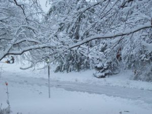 Wide sections of Iowa already had an early, heavy snow during a squall that hit in mid-October, dumping up to nine inches of snow in some areas. “It was definitely a little taste of what’s probably to come,” Martin says. “We know that even in winters where we see well-below-normal snowfall, we still usually get something that comes through and has a significant impact on transportation and other aspects of our lives.” Some forecasters predict a harsh winter is ahead, but Martin says we’re just starting to make some educated guesses.
“We’re in a La Nina pattern as we go into this winter,” Martin says. “What that means for Iowa, it’s not a strong signal necessarily one way or the other. Usually, just to our north, you’re looking at below-normal temperatures and maybe a snowier winter than what you’d typically see. Will that drop as far south into Iowa? We’re going to have to wait and see.”


