Today: Scattered showers & tstrms ending; Partly cloudy. High 82. NW @ 10-15 mph.
Tonight: Fair to P/Cldy. Low 48. Winds light & variable.
Tomorrow: Mostly sunny. High 81. S @ 10.
Sunday: Mostly cloudy w/scatterd shwrs & tstrms. High 72.
Monday: P/Cldy. High 77.
Thursday’s High in Atlantic was 91. Rainfall overnight amounted to .43″ Our Low this morning, was 60. Last year on this date the High in Atlantic was 69 and the Low was 35. The Record High on this date was 95 in 1915. The Record Low was 23 in 1997.
(Johnston, Iowa) – The National Weather Service Cooperative Observer Program (COOP) was formed in the late 1800s and has continued across much of Iowa to this day. Officials with the Weather Service in Central Iowa said the volunteer program is currently struggling however, with numerous vacancies leading to gaps in the climate record in many locations.

KJAN photo from Jan. 6, 2014.
The official records, officials says, are invaluable to learning more about floods, droughts, heat and cold waves, agricultural planning and assessment, engineering, and litigation. Observations can also play a critical part in deciding whether local communities receive state and federal disaster declarations and benefits. If observations are not available for your location, officials may determine these declarations, with hundreds of thousands if not millions of dollars on the line, based on surrounding observations, which may or may not be representative of your community.

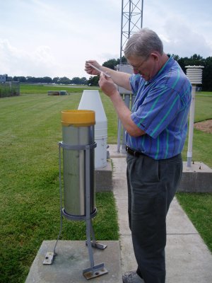
CoOp Observer taking rain gauge measurement. (NWS)
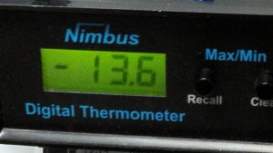
The NWS in Johnston is asking for persons to help with record keeping, especially persons who are able to record data at the same time every day. Co-op observers are volunteers who use equipment (digital thermometers, an official rain gauge and other tools) provided by the National Weather Service, and routinely record daily high and low temperatures, as well as precipitation and snowfall amounts, at a particular time, often 7am (a 24-hour cycle). You will receive instructions on how and where to measure snow. The observations should only take you a few minutes per day.
In southwest Iowa, a Co-Op observer is needed in Bedford, which began keeping the official records in 1898, and in Beaconsfield, where records have been kept since 1951. If you, or another weather enthusiast you know, would be interested in being a part of this long standing network or would like more information, please contact either Cory Martin or Allan Curtis by emailing the office at dmx.coop@noaa.gov or calling (515) 270-4501.
Here is the list of communities where Observers are needed the most (and the year the records were first recorded)
Albia (1894); Ankeny (1950); Beaconsfield (1951); Bedford (1898); Britt (1897); Clarion (1944); Conrad (1977); Gilman (1899); Harcourt (1963); Hubbard (1973); Jewell (1949); Lorimor (1950); Ottumwa (1894); Parkersburg (1951); Tripoli (1946); Winterset (1893).
Today: Areas of fog this morning; Partly cloudy, warm & humid. High 93. S @ 15-25 mph.
Tonight: P/Cldy to Cldy w/scattered showers & thunderstorms. Low 68. S @ 10-15.
Tomorrow: Showers & tstrms ending; P/Cldy. High near 80. NW @ 10-15.
Saturday: P/Cldy. High 80.
Sunday: Mostly cldy w/showers & tstorms. High 75.
Wednesday’s High in Atlantic was 90. Our this morning, 71. Last year on this date the High in Atlantic was 64 and the Low was 32. The Record High on this date was 94 in 1956. The Record Low was 25 in 1895.
Today: A 20 percent chance of showers and thunderstorms after 4pm. Partly sunny, with a high near 91. Breezy, with a south southeast wind 6 to 16 mph, with gusts as high as 23 mph.
Tonight: A 30 percent chance of showers and thunderstorms, mainly before 7pm. Mostly cloudy, then gradually becoming mostly clear, with a low around 68. South wind 10 to 14 mph, with gusts as high as 22 mph. New precipitation amounts of less than a tenth of an inch, except higher amounts possible in thunderstorms.
Tomorrow: Mostly sunny, with a high near 93. Windy, with a south wind 10 to 15 mph increasing to 16 to 21 mph in the afternoon. Winds could gust as high as 29 mph.
Friday: A 30 percent chance of showers and thunderstorms, mainly after 1pm. Partly sunny, with a high near 80. New rainfall amounts of less than a tenth of an inch, except higher amounts possible in thunderstorms.
Saturday: Sunny, with a high near 79.
Today: Partly cloudy w/isolated morning showers. High 82. E/NE @ 10 mph.
Tonight: P/Cldy w/isolated showers & thunderstorms late. Low 64. SE @ 5-10.
Tomorrow: P/Cldy. High near 90. S @ 10-20.
Thursday: P/Cldy. High near 90.
Friday: A chance of showers/thunderstorms. High 82.
Monday’s High in Atlantic was 93. We received just .01″ rain overnight. Our Low was 66. Last year on this date, the High in Atlantic was 64 and the Low, 35. The Record High was 97 in 2011, and the Record Low was 26 in 1966.
(Radio Iowa) – Temperatures have shot up into the 80s and 90s today across Iowa. National Weather Service meteorologist, Roger Vachalek says the temperature isn’t the only thing making it warm. “Along with that you’ve noticed a rapid increase in a humidity level so it feels exactly like you would expect for summertime,” he says, “and that’s going to continue for the next couple of days across the region. A little cooler tomorrow but we’ll be back up again around 88 or 90 come Wednesday, and then Thursday. not so much of a change — and then into the weekend we start to cool off.”
We’ve already seen a lot of ups and downs in temperatures this year — but Vachalek says the next one won’t be as extreme. Gonna be a stairstep. Friday we’ll have a high of around 80 And then Saturday we’ll be back to 77. And then towards Sunday and Monday right around 70 degrees,” Vachalek says “So we really get into somewhat we would call more seasonal weather towards the end of the weekend and into early next week, but for now we’re way above normal or normal highs right around 70 or so this time of the year.” There’s good news for those itching to get their gardens planted.
“We’re probably not going to see freezing temperatures again at least next week it’s just going to be that lows will be in the 40s and 50s,” Vachalek says, “so certainly plants can survive that, and we’re getting past the time of the year when it’s less much less likely to see that sort of thing.” The high temperatures have been accompanied by heavy winds — but that will change.
“A trough of low pressure which is really a wind shift line is going to approach the state. Now keep in mind that it’s going to do a number of things overnight tonight. That is going to bring us a pretty good chance for showers and thunderstorms, especially over northeastern Iowa. And those storms may begin to build back into central and southern Iowa during the later evening and overnight,” he says.”We do have a risk tonight for some strong to severe storms, and maybe some locally heavy rainfall and some of the storms that do get going.”
“The winds will die off but we will have a threat then for some severe weather as we get into the nighttime hours tonight, especially in parts of Northern Iowa and then possibly extending back into southern Iowa a bit later on,” Vachalek says. He says it’s not looking like we will get many record highs today.
Today: Partly cloudy & windy. High near 90. S @ 20-35 mph.
Tonight: P/Cldy w/isolated showers & thunderstorms. Low 62. S-NE @ 5-10.
Tomorrow: Isolated morning shwrs & tstrsms; Becoming P/Cldy. High 86. SE @ 10-15.
Wednesday: P/Cldy & breezy. High near 90. Cloudy, breezy & warmer. High 89. S @ 15-30.
Thursday: P/Cldy & breezy. High again near 90.
Sunday’s High in Atlantic was 66. Our Low was 56. We received .47″ rain Sunday. Last year on this date, the High in Atlantic was 60 and the Low, 36. The Record High was 96 in 1895, and the Record Low was 24 in 1980.
(Radio Iowa)- Iowa’s weather pattern is expected to make a big shift this week, from cold and rainy to hot and humid, raising familiar concerns about drought. Meteorologist Doug Kluck, climate services director for the Central Region of the National Weather Service, based in Kansas City, says some forecasts show improving conditions in the months ahead across the Missouri River basin.
“The forecasters in this case pared back drought substantially across almost the entire basin, really,” Kluck says. “I’ll cross my fingers and hope this comes true.” While Iowa’s high temperatures last week were mostly in the 40s, 50s and 60s, the week ahead promises highs climbing into the 70s and 80s to near 90. Looking ahead, Kluck says there are conflicting signals.
“Short term, temperatures are sort of a mixed bag,” Kluck says. “There’s going to be some warmth and that’s going to be realized in the eastern part of the basin. Precipitation slightly favors above normal, that’s good. Long term, not so good. Above normal temperatures and drier than normal conditions are what the current outlooks say.” Forecasters had expected the La Nina weather pattern to fade away in the past few months, but that hasn’t happened.
“We’re hanging on to La Nina this year through the summer,” Kluck says. “We don’t know if that’s going to hang into the fall or not yet, but La Nina is what we had the last few years and it tends to have a dry and warm aspect to it. So, La Nina is not necessarily our friend.” The U-S Drought Monitor map issued for Iowa late last week showed little change from the week before, with no drought at all in roughly 56 counties, 30 counties were abnormally dry, and 10 counties were considered in moderate drought. Parts of three northwest Iowa counties, Plymouth, Monona and Woodbury, were in severe drought.
DAY ONE…Today and tonight
Thunderstorms will move into the area this morning and remain periodic throughout the day and evening. The threat for severe weather is low, but some storms may produce small hail and locally heavy rainfall.
DAYS TWO THROUGH SEVEN…Monday through Saturday
Additional thunderstorms are possible Monday evening through Monday night, mainly across northern and eastern Iowa. A few of these storms may become severe, with large hail and damaging winds being the primary threats. Locally heavy rainfall would also be possible. Chances for scattered thunderstorms remain for the duration of the week.
Temperatures by the middle of next week may reach above 90 degrees in some locations. Heat index values may approach the upper 90s at times.
SPOTTER INFORMATION STATEMENT…
Spotters will not be needed at this time.