
Today: Areas of frost before 9am. Otherwise, sunny, with a high near 71. Light and variable wind.
Tonight: Partly cloudy, with a low around 42.
Tomorrow: Sunny, with a high near 77. Winds becoming S/SW @ 5-10 mph in the afternoon.
Tuesday Night: Mostly clear, with a low around 46. South wind 5 mph.
Wednesday: Sunny, with a high near 83.
Wednesday Night: Mostly clear, with a low around 49.
Thursday: Sunny, with a high near 83.
Sunday’s High in Atlantic was 70. Our Low this morning was 30. Last year on this date, the High in Atlantic was 62 and the Low was 34. The Record High in Atlantic on Oct. 7th was 88 in 1938. The Record Low was 16 in 1952 & 2012. Sunrise: 7:22. Sunset: 6:52.
(Atlantic, Iowa – KJAN) – Weather data for the month of September, 2024, in Atlantic, shows we were hotter and drier than normal. The average High for the month came in six-degrees warmer, at 83 degrees. The average Low was slightly cooler, coming in at 49 degrees, or about two-degrees under the norm. Rainfall showed a deficit of 3.52-inches. Atlantic received just .29″ of rain last month. The data was compiled at KJAN, the official National Weather Service reporting site for Atlantic.
Looking ahead, we find the High temperature for the month of October in Atlantic, typically averages out to 63 degrees, while the average Low should be around 39. Precipitation typically amounts to 2.76 inches. Check back with us in November to see how our actual weather data compared to the historical averages.
Today: Sunny & breezy, with a high near 71. N/NW winds 15-25 mph. There is an elevated FIRE DANGER risk today due to strong winds and low humidity. Burning is strongly discouraged. A Burn Ban is in effect for Cass & area Counties.
Tonight: Mostly clear w/areas of frost after 4am. Low around 35.
Monday: Areas of frost before 8am. Sunny, with a high near 72. S/SW winds 5 mph.
Monday Night: Mostly clear, with a low around 41.
Tuesday: Sunny, with a high near 77. S/SW winds @ 5-10 mph in the afternoon.
Tuesday Night: Clear, with a low around 47.
Wednesday: Sunny, with a high near 82.
Atlantic broke a Record High Temperature on Saturday. The old record for Oct. 5th was 93 in 1963. Our High yesterday was 96! The Low was 41. Last year on this date, the High in Atlantic was 56 and the Low was 34. The Record High in Atlantic on Oct. 6th was 91 in 1963 & 1997. The Record Low was 15 in 2012. Sunrise: 7:22. Sunset: 6:54.
[Red Oak, Iowa] – An open burn ban is now in effect for all areas and jurisdictions within Montgomery County. The ban prohibits all open and controlled burning in Montgomery County, including all incorporated city limits within the county.
Montgomery County Emergency Management Coordinator Brian Hamman says record high temperatures, limited to no moisture and continued drought conditions have created dangerous fire conditions throughout the entire area. The extended forecast outlooks show well above normal temperatures as well as extremely windy conditions causing concern that any outdoor fire will become large and out of control in a very short amount of time.
Citizens are reminded to not throw out cigarettes from moving vehicles and to discontinue burning yard waste, piled tree debris, grass/agricultural ground and set asides or other items during this ban. Small recreational campfires are permitted only if they are conducted in a fireplace of brick, metal or heavy one-inch wire mesh, however extreme caution should be
taken. Any campfire not in an outdoor fireplace is prohibited. 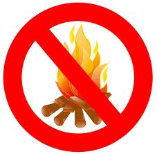
Violation of a burn ban can subject a person to criminal charges as well as civil liabilities for any damages, losses or injuries resulting from the fire. The open burn ban is anticipated to remain in effect until the county receives substantial precipitation alleviating the increased fire danger risk.
Burn bans are also in effect for the following area counties: Cass, Adair, Audubon, Guthrie, Harrison, Mills, Shelby, Monona, Crawford and Carroll.
Today: Sunny with a high near 75. East northeast wind 10 to 15 mph, with gusts as high as 25 mph.
Tonight: Mostly clear with a low around 52. Southeast wind around 10 mph.
Saturday: Sunny with a high near 92. Windy with a south southeast wind 10 to 15 mph becoming south southwest 20 to 25 mph in the afternoon. Winds could gust as high as 35 mph.
Sunday: Sunny with a high near 73. Breezy, with a northwest wind 5 to 15 mph, with gusts as high as 25 mph.
Monday: Sunny with a high near 73.
Tuesday: Sunny with a high near 78.
Today: Sunny with a high near 81. East northeast wind 5 to 15 mph, with gusts as high as 20 mph.
Tonight: Partly cloudy with a low around 47. North northeast wind 10 to 15 mph, with gusts as high as 25 mph.
Friday: Sunny with a high near 74. East wind 10 to 15 mph, with gusts as high as 20 mph.
Saturday: Sunny with a high near 89. Windy, with a south southeast wind 10 to 15 mph increasing to 20 to 25 mph in the afternoon. Winds could gust as high as 30 mph.
Sunday: Sunny with a high near 74.
Monday: Sunny with a high near 73.
(Radio Iowa) – Iowans will hear some new terminology when the winds of winter start to blow. National Weather Service meteorologist Chad Hahn says the agency is abandoning a few familiar terms in favor of language that’s a little more direct.
If the air temperature is ten-below-zero, that’s quite frigid whether there’s a breeze or not, so Hahn says it makes sense to have an alternative to wind chill advisories when it’s not windy.
The term “wind chill” isn’t going away, as Hahn says it remains very useful during the winter months to describe what the air temperature feels like with a combination of cold temperatures and sustained winds.
 It’s possible we’ll hear about the heat index again in a few days, as the forecast calls for parts of Iowa to see unseasonably warm high temperatures in the low 90s by the weekend.
(Radio Iowa) – State climatologist Justin Glisan confirms September is at the top of the record list after recording just seven-tenths of an inch of precipitation.
He says it was a warm one as well.
Glisan says the early outlook for October doesn’t show much change from September.
He says it doesn’t look like we will make up the lost precipitation from September anytime soon.
The State Fire Marshal’s website shows burn bans in 16 counties due to the dry conditions.
Today: Sunny with a high near 81. Breezy with a south southwest wind 5 to 10 mph increasing to 15 to 20 mph in the morning. Winds could gust as high as 30 mph.
Tonight: Mostly clear with a low around 44.
Thursday: Sunny with a high near 80.
Friday: Sunny with a high near 75. East wind around 10 mph, with gusts as high as 20 mph.
Saturday: Sunny with a high near 92. Windy.
Sunday: Sunny with a high near 73. Breezy.


