
COUNTIES: SAC-CRAWFORD-CARROLL-AUDUBON-GUTHRIE-DALLAS-CASS-ADAIR-MADISON-ADAMS-UNION-TAYLOR-RINGGOLD…
349 AM CDT SUN SEP 1 2013
TODAY AND TONIGHT: SCATTERED THUNDERSTORMS ARE POSSIBLE SOUTHEAST OF A LINE FROM WATERLOO TO DENISON THROUGH 11 AM. SEVERE STORMS ARE NOT EXPECTED HOWEVER ISOLATED STORMS COULD PRODUCE HAIL TO THE SIZE OF NICKELS AND WIND GUSTS TO 45 MPH.
4:06-a.m. 40-to 50-mph winds downed 12-to 14″ tree limbs in Dallas Center (Dallas Co.)
3:12-a.m. 3/4″ diameter hail reported in Council Bluffs by a trained NWS spotter. (Pottawattamie Co.)
328 AM CDT SUN SEP 1 2013
EARLY THIS MORNING…THUNDERSTORMS LIKELY. NORTHWEST WIND NEAR 5 MPH. CHANCE OF THUNDERSTORMS 60 PERCENT.
TODAY…PARTLY SUNNY UNTIL LATE AFTERNOON THEN BECOMING SUNNY. A 20 PERCENT CHANCE OF THUNDERSTORMS THROUGH MID MORNING. HIGH IN THE MID 80S. NORTH WIND 10 TO 15 MPH.
TONIGHT…CLEAR…COOLER. LOW IN THE LOWER 50S. NORTH WIND 5 TO 10 MPH.
LABOR DAY…SUNNY. HIGH AROUND 80. NORTH WIND 5 TO 10 MPH.
MONDAY NIGHT…MOSTLY CLEAR. LOW AROUND 50. EAST WIND AROUND 5 MPH.
TUESDAY…MOSTLY SUNNY. HIGH IN THE MID 80S. SOUTH WIND AROUND5 MPH.
TUESDAY NIGHT AND WEDNESDAY…PARTLY CLOUDY. LOW IN THE LOWER 60S. HIGH IN THE UPPER 80S.
331 AM CDT SUN SEP 1 2013
CRAWFORD-CARROLL-GREENE-AUDUBON-GUTHRIE-CASS-ADAIR-
…STRONG THUNDERSTORMS WITH GUSTY WINDS EXPECTED…
AN AREA OF STRONG THUNDERSTORMS WITH GUSTY WINDS WILL BE PASSING THROUGH THE REGION BETWEEN 330 AM AND 430 AM THIS SUNDAY MORNING. WINDS OF 35 TO 45 MPH CAN BE EXPECTED WITH THE POTENTIAL FOR SOME SMALL HAIL AS WELL. THE STORMS ARE MOVING TO THE SOUTHEAST AT 40 MPH.
CARROLL-GREENE-AUDUBON-GUTHRIE-CASS-ADAIR-
INCLUDING THE CITIES OF...CARROLL...JEFFERSON...AUDUBON...
GUTHRIE CENTER...ATLANTIC...GREENFIELD
303 AM CDT SUN SEP 1 2013

...STRONG THUNDERSTORMS WITH GUSTY WINDS EXPECTED...

AN AREA OF STRONG THUNDERSTORMS WITH GUSTY WINDS WILL BE PASSING
THROUGH THE REGION BETWEEN 300 AM AND 430 AM THIS SUNDAY MORNING.
WINDS OF 35 TO 45 MPH CAN BE EXPECTED WITH THE POTENTIAL FOR SOME
SMALL HAIL AS WELL. THE STORMS ARE MOVING TO THE SOUTHEAST AT 40
MPH.
.A SEVERE THUNDERSTORM WARNING REMAINS IN EFFECT UNTIL 400 AM CDT
FOR MILLS AND EASTERN SARPY COUNTIES…
AT 329 AM CDT…A SEVERE THUNDERSTORM WAS LOCATED NEAR PAPILLION…OR 10 MILES SOUTH OF OMAHA…MOVING EAST AT 35 MPH. QUARTER SIZE HAIL AND 60 MPH WIND GUSTS ARE POSSIBLE WITH THIS STORM.
************
323 AM CDT SUN SEP 1 2013
THE NATIONAL WEATHER SERVICE IN OMAHA HAS ISSUED A SEVERE THUNDERSTORM WARNING FOR…MILLS COUNTY IN SOUTHWEST IOWA…NORTHEASTERN CASS COUNTY IN SOUTHEAST NEBRASKA…EASTERN SARPY COUNTY IN EAST CENTRAL NEBRASKA…UNTIL 400 AM CDT
* AT 320 AM CDT…A SEVERE THUNDERSTORM WAS LOCATED NEAR PACIFIC JUNCTION…OR 17 MILES SOUTHEAST OF OMAHA…MOVING SOUTHEAST AT 35 MPH.
HAZARD…QUARTER SIZE HAIL AND 60 MPH WIND GUSTS.
SOURCE…RADAR INDICATED.
IMPACT…HAIL DAMAGE TO VEHICLES IS EXPECTED. EXPECT WIND DAMAGE TO ROOFS…SIDING AND TREES.
* LOCATIONS IMPACTED INCLUDE…BELLEVUE…PAPILLION…LA VISTA…PLATTSMOUTH…GLENWOOD…MALVERN…PACIFIC JUNCTION…EMERSON…CEDAR CREEK…OFFUTT AFB…TABOR…SILVER CITY…HENDERSON…HASTINGS AND CAMP OMAHA.
PRECAUTIONARY/PREPAREDNESS ACTIONS…
FOR YOUR PROTECTION MOVE TO AN INTERIOR ROOM ON THE LOWEST FLOOR OF A BUILDING.
The National Weather Service forecast for Atlantic and the KJAN listening area, and weather information for Atlantic….

Podcast: Play in new window | Download (782.8KB)
Subscribe: RSS
State Fire Marshal Raymond Reynolds has ordered a ban on open burning in Audubon County, effective at Noon today (Sat., Aug. 31st).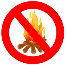 No one is allowed to engage in open burning in Audubon County, except as specifically permitted by Iowa Code, or until Audubon Fire Chief John Ballou (who represents each fire department in the County), notifies the Fire Marshal that conditions have improved, and no longer threatens life or property.
The burn ban was requested by Ballou, after consulting with fire chiefs in the County, and was made due to the extremely dry nature of brush, grass and timber in the County. If fires start, they can spread rapidly and become out of control.
Today: Areas of fog before 8am. Otherwise, sunny, with a high near 95. Heat index values as high as 100. Light north northeast wind.
Tonight: A 50 percent chance of showers and thunderstorms, mainly between 1am and 4am. Increasing clouds, with a low around 67. Calm wind. New rainfall amounts between a tenth and quarter of an inch, except higher amounts possible in thunderstorms.
Sunday: A 10 percent chance of showers and thunderstorms before 7am. Sunny, with a high near 85. North northwest wind 5 to 13 mph.
Sunday Night: Mostly clear, with a low around 56. North wind 5 to 10 mph.
Labor Day: Sunny, with a high near 80. North wind 5 to 9 mph.
Monday Night: Clear, with a low around 54.
Tuesday: Sunny, with a high near 83.
The (podcast) weather forecast from Freese-Notis, and weather information for Atlantic…
Podcast: Play in new window | Download (876.7KB)
Subscribe: RSS


