
Skyscan Forecast Wednesday, July 6, 2022 Dan Hicks
Today: Partly cloudy to cloudy. Scattered showers and t’storms. NE @ 5-10. High 87.
Tonight: Partly cloudy to cloudy. Showers and t’storms. E @ 5-10. Low 68.
Thursday: Partly cloudy to cloudy. Scattered showers and t’storms. ESE @ 5-10. High 84.
Friday: Showers early in the day then becoming partly cloudy. High 86.
Saturday: Partly cloudy. High 86.
Skyscan Forecast Tuesday, July 5, 2022 Dan Hicks
Today: Mostly sunny. Isolates showers possible early. SSW @ 10-20. High 98.
Tonight: Partly cloudy. Scattered showers and t’storms late. S @ 5-10. Low 75.
Wednesday: Partly cloudy to cloudy. Scattered showers and t’storms. Variable winds at 5-10. High 90.
Wednesday night: Mostly cloudy. Showers and t’storms likely. Low 70.
Thursday: Partly cloudy to cloudy. Scattered showers and t’storms. High 86.
Friday: Showers and t’storms in the morning, then partly cloudy. High 86.
(Radio Iowa/KJAN) – State Climatologist Justin Glisan says the month of June ended up being a little on the warm side. “The statewide average temperature, we were about 71point-seven degrees, and that’s nearly two degrees above average,” Glisan says. He says it took about half of June before the heat really took over. “We started the month off actually near normal to slightly cooler than average and then we get into the middle of the month and the atmospheric furnace turned on,” Glisan says. “And we had a stretch of days in the 80s and 90s with dew points up in the 70s and 80s. So triple-digit heat indices, So very warm as we ended the month.”
June went against the norm in many areas of the state when it comes to precipitation.” June is the wettest month climatologically for the northern two-thirds of the state. And we were about an inch and a half below average, the statewide average was about three and three-quarters of an inch,” according to Glisan. “So that’s pretty dry when you’re considering it’s the wettest month and hence we saw drought expansion, D-one D-two, and even the introduction of D-3 drought in the northwestern corner, and then some abnormally dry conditions creeping into the southwest and in eastern Iowa.” July is off to a warm start and Glisan says that’s the signal right now.
“We do have high probabilities of warmer temperatures for the month and then for the first half of the month if you look at those short-term outlooks six to 10, and eight to 14-day outlook,” Glisan says. “Now coupled with that, on the precipitation side though, we are seeing an elevated signal for wetter conditions. So that’s a good signal to see when you do see the probability of warmer temperatures.” He says wetter conditions could help with some of the expansion of the drought conditions we saw in June.
Weather data compiled at the KJAN Studios for the month of June, show we were a little warmer than normal temperature-wise, but below normal for rainfall, despite two days when we received over 1.5-inches of rain. The average High last month was 85 (two-degrees above normal). The average Low was 61 (also two-degrees above normal). Rainfall amounted to 3.9 inches, as compared to the normal 4.98-inches. We had two significant, separate hail events, on the 7th and 14th.
The hottest June day was on the 13, when we reached 100 degrees. Looking at the norms for July, the High averages 86, the Low 63, and rainfall typically totals just under 5-inches (4.62″).
Skyscan Forecast Monday, July 4, 2022 Dan Hicks
Happy Independence Day
*Heat Advisory in place through Tuesday night.*
Today: Showers and thunderstorms ending in the morning. Becoming partly cloudy. S @ 15-25. High 90.
Tonight: Fair to partly cloudy. S @ 5-10. Low 74.
Tuesday: Partly to mostly sunny. SW @ 10-15. High 98.
Tuesday Night: Partly cloudy. Scattered showers and thunderstorms. SSW @ 5. Low 74.
Wednesday: Partly cloudy. A few isolated showers and thunderstorms. High 90.
Thursday: Partly cloudy to cloudy. Scattered showers and t’storms. High 88.
Yesterday’s high was 87. Last night’s low was 64. This day last year the high was 87 and the low was 66. The all-time record high was 111 set in 1936 and the record low was 41 in 1967. Sunrise is 5:51 a.m. and sunset will be 8:57 p.m.
Area Counties: Sac-Crawford-Carroll-Audubon-Guthrie-Dallas-Polk-Cass- Adair-Madison-Adams-Union-Taylor-Ringgold– HEAT ADVISORY IN EFFECT FROM 1 PM MONDAY TO 8 PM CDT TUESDAY…
* WHAT…Heat index values to near or above 105 expected.
Area Counties: Monona-Harrison-Shelby-Pottawattamie-Mills-Montgomery-Fremont-Page
…HEAT ADVISORY IN EFFECT FROM NOON MONDAY TO 7 PM CDT TUESDAY...
* WHAT…Heat index values up to 108 expected. 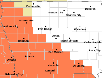
IMPACTS…Hot temperatures and high humidity may cause heat illnesses to occur.
PRECAUTIONARY/PREPAREDNESS ACTIONS… Drink plenty of fluids, stay in an air-conditioned room, stay out of the sun, and check up on relatives and neighbors. Young children and pets should never be left unattended in vehicles under any circumstances. Take extra precautions if you work or spend time outside. When possible reschedule strenuous activities to early morning or evening. Know the signs and symptoms of heat exhaustion and heat stroke.
Wear lightweight and loose fitting clothing when possible. To reduce risk during outdoor work, the Occupational Safety and Health Administration recommends scheduling frequent rest breaks in shaded or air conditioned environments. Anyone overcome by heat should be moved to a cool and shaded location. Heat stroke is an emergency! Call 9 1 1.
Today: Mostly sunny, with a high near 86. Light southeast wind becoming south southeast 8 to 13 mph in the morning.
Tonight: A 50 percent chance of showers and thunderstorms after 1am. Mostly cloudy, with a low around 72. South wind 6 to 11 mph. New rainfall amounts between a quarter and half of an inch possible.
Independence Day: A 10 percent chance of showers and thunderstorms before 1pm. Cloudy through mid morning, then gradual clearing, with a high near 94. Heat index values as high as 102. Breezy, with a south southwest wind 10 to 17 mph, with gusts as high as 24 mph.
Monday Night: A 20 percent chance of showers and thunderstorms. Mostly clear, with a low around 74. Breezy, with a south wind 8 to 16 mph, with gusts as high as 25 mph.
Tuesday: A 20 percent chance of showers and thunderstorms after 1pm. Sunny and hot, with a high near 97. South southwest wind 7 to 10 mph, with gusts as high as 20 mph.
Wednesday: A chance of showers, with thunderstorms also possible after 1pm. Mostly sunny, with a high near 93. Chance of precipitation is 40%.
Saturday’s High in Atlantic was 83. The Low was 59. Last year on this date (July 3), the High in Atlantic was 88 and the Low was 62. The Record High was 107 in 1936, and the Record Low was 43 in 1967 & 1968.
Today: Partly cloudy. High 83. S @ 10.
Tonight: Mostly clear. Low 65. S @ 10
Tomorrow: P/Cldy to Cldy & humid, w/a slight chance of showers & thunderstorm. High 80. S @ 10-15.
Monday (Independence Day): P/Cldy w/a slight chance of showers & thunderstorms. High 95. S @ 10-20.
Tuesday: A slight chance of thunderstorms, otherwise mostly sunny. High 94. S @ 10-15.
Friday’s High in Atlantic was 79. Our Low was 55. Rainfall on Friday amounted to .34″ at KJAN. Last year on this date the High in Atlantic was 89 and the Low was 60. The Record High on this date was 102 in 1911. The Record Low was 45 in 1924 & 1959.
Weather data compiled at the KJAN Studios for the month of June, show we were a little warmer than normal temperature-wise, but below normal for rainfall, despite two days when we received over 1.5-inches of rain. The average High last month was 85 (two-degrees above normal). The average Low was 61 (also two-degrees above normal). Rainfall amounted to 3.9 inches, as compared to the normal 4.98-inches. We had two significant, separate hail events, on the 7th and 14th.
The hottest June day was on the 13, when we reached 100 degrees. Looking at the norms for July, the High averages 86, the Low 63, and rainfall typically totals just under 5-inches (4.62″). We’ll let you know how the actual numbers fared for July, on August 1st.
Today: Partly cloudy to cloudy w/scattered showers & thunderstorms this morning. High 82. N @ 10.
Tonight: P/Cldy. Low 60. Winds light & variable.
Tomorrow: P/Cldy to Cldy w/scattered shwrs & tstrms. High 84. SE @ 10-15.
Sunday: P/Cldy. High 86.
Monday (Independence Day): Morning showers & tstrms, otherwise P/Cldy. High 89.
Thursday’s High in Atlantic was 90. Our Low was 70. Last year on this date the High in Atlantic was 87 and the Low was 58. The Record High on this date was 104 in 1938. The Record Low was 45 in 1930, 1951 & 1995.


