
(Radio Iowa) – State Climatologist, Justin Glisan says June, July and August have been warmer and drier than normal for the last three years. Glisan says the La Nina weather pattern is to blame and it could impact fall as well. “We still see an elevated chance of warmer and drier temperatures for September and then you look at the seasonal meteorological fall time slice — September October November — we’re seeing that signal through those three months,” Glisan says.
He says La Nina is a cold sea surface temperature anomaly in the Pacific that impacts where the storm tracks set up over the United States. It could hang around through winter. “We don’t want to get ahead of ourselves in terms of winter forecasts. But when we do see that La Nina interface hanging around, we do see a tendency towards warmer temperatures across the southern part of the United States, colder temperatures across the northern part of the United States, and then we’re stuck right in the middle of that interface,” he says. “So it’s just a coin flip right now, but again, too far out seasonally.”
Glisan say the La Nina impact has been felt across much of the upper Midwest.
Today: Areas of fog this morning; Becoming partly cloudy. High 82. E @ 10-15.
Tonight: P/Cldy. Low 62. SE @ 5.
Tomorrow: P/Cldy. High 85. S @ 10-15.
Wednesday: P/Cldy. High 87.
Thursday: P/Cldy. High near 90.
Sunday’s High in Atlantic was 79. Our Low was 55. Last year on this date the High in Atlantic was 83 and the Low was 54. The Record High on this date was 104 in 1913. The Record Low was 34 in 1962.
Today: Mostly sunny, with a high near 77. East northeast wind 5 to 10 mph.
Tonight: Partly cloudy, with a low around 58. East wind 5 to 10 mph.
Labor Day (Monday): Mostly sunny, with a high near 80. East southeast wind 5 to 10 mph.
Monday Night: Mostly clear, with a low around 60. East southeast wind around 5 mph becoming calm after midnight.
Tuesday: Sunny, with a high near 83. Calm wind becoming east southeast 5 to 10 mph in the morning.
Tuesday Night: Mostly clear, with a low around 60.
Wednesday: Sunny, with a high near 85.
Saturday’s High in Atlantic was 82 and the low was 56. This day last year the high was 77 and the low 54. The all-time record high was 101 in 1918 and the record low was 33 in 1891. Sunrise is 6:48 a.m. and Sunset will be 7:48 p.m.
Skyscan Forecast Saturday, September 3, 2022 Austin Romer
Today: Partly cloudy, clearing through the day. N @ 15. High 81.
Tonight: Mostly clear. NE @ 10. Low 61.
Sunday: Partly cloudy. NE @ 10. High 80.
Sunday Night: Clear. E @ 5-10. Low 58.
Monday (Labor Day): Mostly Sunny. E @ 10. High 83.
Tuesday: Sunny. SE @ 10. High 94.
Yesterday’s high was 91 and the low was 62. This day last year the high was 77 and the low 65. The all-time record high was 102 in 1937 and the record low was 32 in 1974. Sunrise is 6:47 a.m. and Sunset will be 7:50 p.m.
Skyscan Forecast Friday, September 2, 2022 Dan Hicks
Today: Areas of fog early then partly cloudy. A few scattered showers and thunderstorms this afternoon. S @ 10-15. High 90.
Tonight: Partly to mostly cloudy. A few scattered showers and thunderstorms. S shifting to N @ 5-10. Low 65.
Saturday: Partly cloudy. N @ 10. High 82.
Saturday Night: Mostly clear. NNE @ 5-10. Low 57.
Sunday: Partly cloudy. High 84.
Monday: Partly cloudy. High 88.
Yesterday’s high was 79 and the low overnight was 64. This day last year the high was 75 and the low 65. The all-time record high was 101 in 2000. The record low was 30 in 1893. Sunrise is 6:46 a.m. and Sunset is 7:52 p.m.
(Radio Iowa) – August continued the summer weather pattern that Iowa and the Midwest have been stuck in now for some time. State Climatologist, Justin Glisan, says this pattern includes warmer conditions.
It was also drier, with rainfall averaging three-point-five inches in August.
Glisan says the combined numbers for the three summer months this year are very similar to 2020 and 2021.
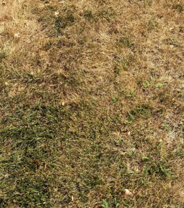
Dry conditions this summer left grass brown. (RI photo)
He says June, July, and August, of this year, continued the drier trend.
Glisan says the drought conditions this year are NOT as bad as they were for the three summer months last year. He says the La Nina weather pattern is behind the warmer, drier summers.
He says that could lead to a warmer winter, but it’s too early to tell that.
(Atlantic, Iowa) – The month of August here in Atlantic was a little on the warm side for average high and very dry for precipitation. The normal average high for August is 83 degrees and this year we averaged at 86.4 degrees for the month. The average low is typically 61 degrees and this year we averaged a low of 59.5 degrees for the low.
It has been pretty evident that we’ve been stuck in a dry spell for the last two months and we once again fell woefully short of average rainfall. Rainfall typically amounts to 3.88-inches, but this year we only managed to get 1.96 inches of rain which did turn out to be 0.7″ more than July.
Looking ahead to the month of September the average high is 77 and the average low is 50. Rainfall in September typically amounts to 3.45 inches. Check back on October 1st to see how our weather fared in September.
Skyscan Forecast- Dan Hicks
Thursday, September 1, 2022
Today: Partly cloudy. SW @10-20. High 90.
Tonight: Partly cloudy. S @ 5-10. Low 68.
Friday: Partly cloudy. A few scattered afternoon showers and thunderstorms. S @ 10-15. High 90.
Friday Night: Slight chance of showers. Partly cloudy. S @ 5. Low 61.
Saturday: Shower possible early, then partly cloudy. High 84.
Sunday: Partly cloudy. High 86.
Monday: Partly cloudy. High 88.
Yesterday’s high was 86 and the low was 51. This day last year we had a high of 81 and low of 55. The all-time record high was 99 in 1913 and the record low was 34 in 1967. Sunrise is 6:45 a.m. this morning and sunset is 7:53 a.m.
Yesterday’s high was 83 and this morning’s low was 50. One year ago the high was 81 and the low 55. The record high for August 31 in Atlantic is 101 degrees set in 1913, the record low is 35 set in 1967. Sunrise this morning is 6:44 am. Sunset tonight is 7:55 pm. Thursday’s sunrise will be at 6:45 am.
Skyscan Forecast Tuesday, August 30, 2022 Dan Hicks
Today: Mostly sunny. NW @ 10-15. High 83.
Tonight: Fair to partly cloudy. Light SW winds. Low 55.
Wednesday: Mostly sunny. SE @ 10-15. High 87.
Wednesday Night: Partly cloudy. S @ 5. Low 62.
Thursday: Partly cloudy. A few isolated showers and thunderstorms. High 87.
Friday: Partly cloudy. A few afternoon thunderstorms. High 90.
Yesterday’s high was 84 and the low was 53. This day last year the high was 87 and the low was 60. The all-time record high was 101 set in 1947. The record low was 33 set in 1893. Sunrise this morning is at 6:44 a.m. and sunset tonight is 7:57 p.m.


