341 AM CDT SUN MAR 15 2015
…EXTREME FIRE DANGER OVER CENTRAL IOWA THIS AFTERNOON…
LOW HUMIDITY AND STRONG SOUTHWEST WINDS COMBINED WITH DRY FUELS WILL LEAD TO A POTENTIALLY DANGEROUS FIRE WEATHER SITUATION THIS AFTERNOON OVER MUCH OF CENTRAL AND WESTERN IOWA.
SAC-CRAWFORD-CARROLL-AUDUBON-GUTHRIE-DALLAS-CASS-ADAIR-MADISON-ADAMS-UNION-RINGGOLD COUNTIES…
RED FLAG WARNING IN EFFECT FROM NOON TODAY TO 7 PM FOR EXTREME FIRE CONDITIONS!
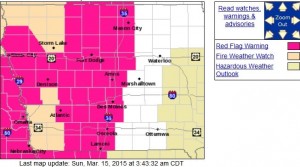
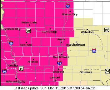
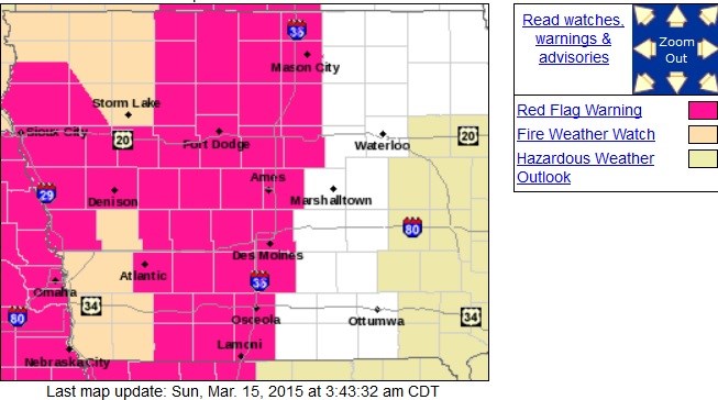
Counties in the pinkish-red color are under a Red Flag Warning this afternoon. The flesh colored counties are in a Fire Weather Watch. (3/15/15)
THE NATIONAL WEATHER SERVICE IN DES MOINES HAS ISSUED A RED FLAG WARNING FOR EXTREME FIRE CONDITIONS…WHICH IS IN EFFECT FROM NOON TODAY TO 7 PM CDT THIS EVENING. THE FIRE WEATHER WATCH IS NO LONGER IN EFFECT.
* WIND…SOUTHWEST WINDS SUSTAINED 20 TO 30 MPH WITH GUSTS UP TO 40 MPH.
* RELATIVE HUMIDITY…AS LOW AS 19 PERCENT.
* FUEL…90 TO 100 PERCENT CURED.
* IMPACTS…ANY FIRES THAT DEVELOP WILL HAVE THE POTENTIAL TO SPREAD RAPIDLY. ANY OUTDOOR BURNING IS HIGHLY DISCOURAGED AND SHOULD BE AVOIDED TODAY.
* TIMING…SHORTLY AFTER NOON CONDITIONS WILL BECOME FAVORABLE FOR RAPID FIRE GROWTH. THIS WILL CONTINUE FOR MUCH OF THE AFTERNOON ENDING IN THE EARLY EVENING.
PRECAUTIONARY/PREPAREDNESS ACTIONS…
A RED FLAG WARNING MEANS THAT CRITICAL FIRE WEATHER CONDITIONS ARE EITHER OCCURRING NOW…OR WILL SHORTLY. A COMBINATION OF STRONG WINDS…LOW RELATIVE HUMIDITY…AND WARM TEMPERATURES WILL CREATE EXPLOSIVE FIRE GROWTH POTENTIAL.