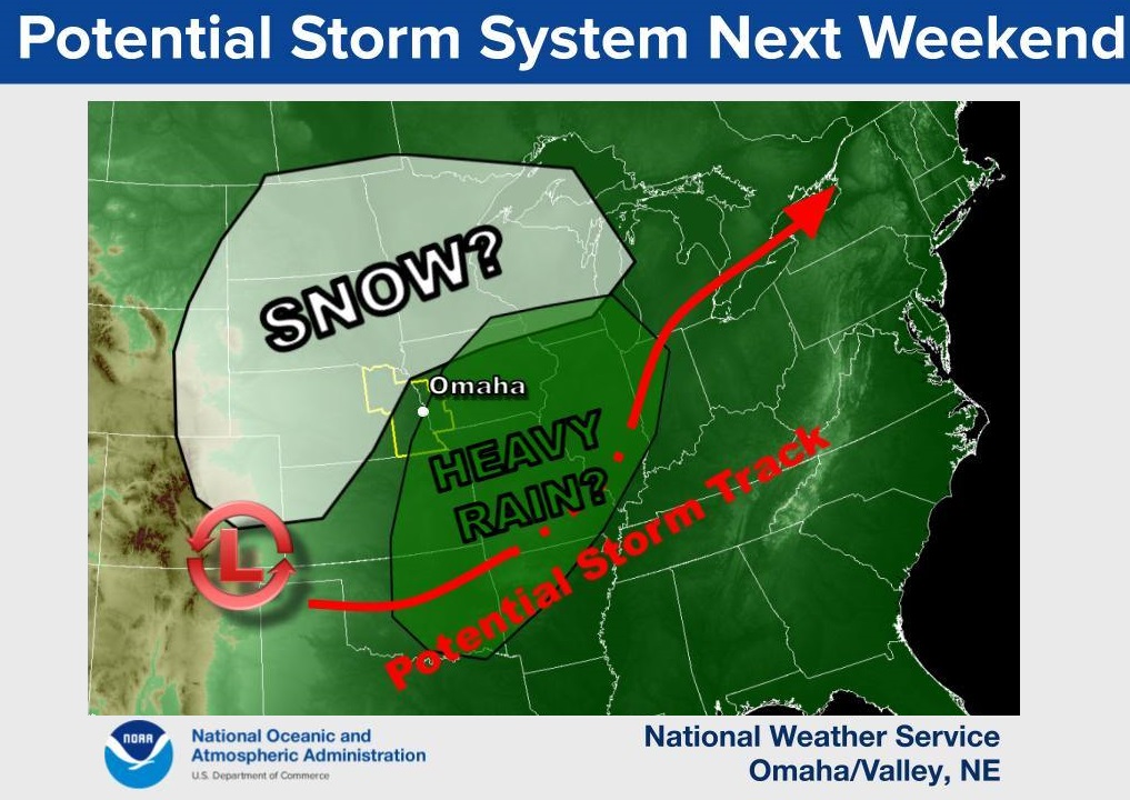
(Radio Iowa) – Don’t put away those heavy coats, shovels and snow-melt just yet. Tomorrow (Tuesday) marks the first day of spring, but it’s possible a large area of Iowa will be digging out from a winter-weather storm in less than a week. Meteorologist Katie Gross, at the National Weather Service office in Omaha, says they’re following a developing weather system that may arrive over Iowa next Sunday, and could last into the following Tuesday.
“The whole system is still kind of up in the air, with all the models not quite agreeing on what exactly is going to play out just yet,” Gross says. “The best consensus we’ve got so far is that there’s probably going to be some snow falling over parts of northern Iowa, with maybe some heavier rain across the rest of the state.” The computer models are not lining up as to the location of the rain-snow line, but for the moment, it appears the northern few tiers of Iowa counties may see snow late next weekend.
“We are not really certain where exactly this will set up,” Gross says. “If the whole system shifts south, more of Iowa could see snow. If it moves north, more of Iowa will be kind of stuck in that warmer air and get some heavier rain.” She says there is still substantial uncertainty with the storm track, but one thing is sure, Mother Nature often doesn’t pay attention to the calendar.
“This time of year, we’re just kind of in that flux between winter and spring,” Gross says. “It kind of bobs back and forth between the two for a few weeks here.” She suggests you keep a close eye on the forecast throughout the week as the details become more clear.


