712 Digital Group - top

Hazardous Weather Outlook for parts of west central/central/southern IA 9/7/15

Weather

September 7th, 2015 by Ric Hanson

AREA COUNTIES: CRAWFORD-CARROLL-GREENE-AUDUBON-GUTHRIE-
DALLAS-CASS-ADAIR-MADISON-ADAMS-UNION-TAYLOR-RINGGOLD
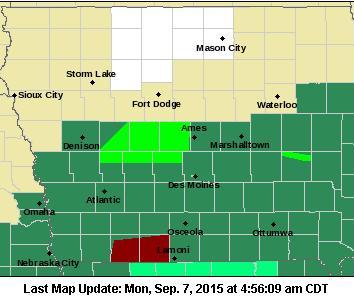
517 AM CDT MON SEP 7 2015

TODAY AND TONIGHT: THUNDERSTORMS CHANCES REMAIN IN THE FORECAST…ESPECIALLY EARLY THIS MORNING SOUTH AND AGAIN TONIGHT CENTRAL AND SOUTH. SOME OF THE STORMS MAY PRODUCE TORRENTIAL RAINS AND POTENTIALLY FLASH FLOODING WITH ONE TO THREE INCHES OF RAIN POSSIBLE…AND A FEW AMOUNTS LOCALLY HIGHER. A FEW STORMS MAY ALSO BE SEVERE TONIGHT WITH DAMAGING WIND AND LARGE HAIL THE PRIMARY THREATS.

A FLASH FLOOD WATCH REMAINS IN EFFECT FOR THE AREA.

TUESDAY THROUGH SUNDAY: THUNDERSTORMS WITH LOCALLY HEAVY RAINS MAY LINGER INTO TUESDAY MORNING. ISOLATED STORMS ARE ALSO POSSIBLE AROUND THURSDAY…AND SUNDAY OR SUNDAY NIGHT. NEITHER SEVERE WEATHER OR HEAVY RAINS ARE EXPECTED
WITH THESE STORMS AT THIS TIME.

.SPOTTER INFORMATION STATEMENT...SPOTTER ACTIVATION MAY BE NEEDED TONIGHT AND INTO EARLY TUESDAY MORNING.

Hazardous Weather Outlook for parts of western/southwest IA 9/7/15

Weather

September 7th, 2015 by Ric Hanson

HARRISON-SHELBY-POTTAWATTAMIE-MILLS-MONTGOMERY-FREMONT-PAGE COUNTIES…
500 AM CDT MON SEP 7 2015

TODAY AND TONIGHT: SEVERE THUNDERSTORMS PRODUCING LARGE HAIL AND DAMAGING WINDS ARE POSSIBLE LATER THIS AFTERNOON AND EVENING. HEAVY RAIN IS LIKELY OVERNIGHT…WITH FLASH FLOODING POSSIBLE. A FLASH FLOOD WATCH IS POSTED.

THE COLD FRONT THAT MOVED THROUGH THE AREA AND TRIGGERED
THUNDERSTORMS SUNDAY NIGHT IS FORECAST TO LIFT BACK NORTH INTO
SOUTHEAST NEBRASKA AND SOUTHWEST IOWA LATER TODAY AND TONIGHT. HIGH INSTABILITY AND MODERATE SHEAR WILL CONTRIBUTE TO THE SEVERE STORM POTENTIAL DURING THE LATE AFTERNOON AND EVENING. ALSO…ABUNDANT ATMOSPHERIC MOISTURE COMBINED WITH EXPECTED TRAINING OF THUNDERSTORMS OVERNIGHT WILL LEAD TO HEAVY RAINFALL AND FLASH FLOODING…ESPECIALLY IN AREAS THAT RECEIVED HEAVY RAIN SUNDAY NIGHT.

TUESDAY THROUGH SUNDAY: THERE IS A CHANCE FOR THUNDERSTORMS ON TUESDAY AS AN UPPER LEVEL LOW PRESSURE SYSTEM MOVES THROUGH THE AREA. ISOLATED THUNDERSTORMS ARE AGAIN POSSIBLE TUESDAY NIGHT THROUGH WEDNESDAY NIGHT.

SPOTTER INFORMATION STATEMENT... SPOTTER ACTIVATION MAY BE NEEDED LATER THIS AFTERNOON AND EVENING.

MARK THOMAS, 64, of Coon Rapids (Svcs. 9/11/15)

Obituaries

September 7th, 2015 by Ric Hanson

MARK THOMAS, 64, of Coon Rapids, died Sun., Sept. 6th, at Thomas Rest Haven in Coon Rapids. Funeral services for MARK THOMAS will be held 10:30-a.m. Fri., Sept. 11th, at the 1st United Methodist Church in Coon Rapids. Ohde Funeral Home in Coon Rapids has the arrangements.

Visitation will be held on Thursday September 10, 2015, 5:00 PM – 7:00 PM at Ohde Funeral Home, Coon Rapid.

Burial will be in the Union Township Cemetery.

Corning teen arrested Sunday night

News

September 7th, 2015 by Ric Hanson

Sheriff’s officials in Montgomery County say a teenager from Adams County was arrested late Sunday night. 17-year old Trevor Ryan Myers, of Corning, was taken into custody at around 11:25-p.m. in the 300 block of 3rd Avenue, in Villisca. Myers faces Possession of a Controlled Substance and Possession of Drug Paraphernalia, charges.  He was later released to the custody of a parent.

Flash Flood Watch/Warning updates 5-a.m. 9/7/15

Weather

September 7th, 2015 by Ric Hanson

The Flash Flood Watch that was in effect for most the KJAN listening area until 10-am today has been cancelled, with the exception of Adams Union Taylor and Ringgold Counties. A Flash Flood Watch will be in effect this evening beginning at 7 o’clock and running through 7-a.m. Tuesday, for Cass-Adair-Adams-Audubon-Guthrie-Dallas-Fremont-Harrison-Mills-Montgomery-Page-Pottawattamie-Shelby-Union-Taylor-Ringgold Counties.

Counties in dark green are under a Flash Flood Watch; Light green: Flood Warning; Counties in dark red: Flash Flood Warning.

Counties in dark green are under a Flash Flood Watch; Light green: Flood Warning; Counties in dark red: Flash Flood Warning.

The National Weather Service says showers and thunderstorms with potentially heavy flash flooding will continue early this morning, but should diminish toward midday. The overall flash flooding potential will not end by then, however. More showers and thunderstorms with heavy rain are expected again tonight. Rainfall amounts may reach one-to three-inches, with locally higher amounts possible. And, with soils already saturated in many areas, more flash flooding may occur.

A Flood Warning remains in effect until 2-a.m. Tuesday for northern Audubon, Dallas, and Guthrie Counties, along with southeastern Carroll County.

NWS forecast for Atlantic & the KJAN listening area, 9/7/15

Weather

September 7th, 2015 by Ric Hanson

A FLASH FLOOD WATCH continues until 10-a.m. today for Adair-Adams-Audubon-Cass-Dallas-Guthrie-Madison-Ringgold-Taylor and Union Counties in our listening area.  A FLOOD WARNING is in effect until 2-a.m. Tuesday for northern Guthrie, southeastern Carroll, northern Audubon and northern Dallas Counties.

Today (Labor Day): A 40 percent chance of showers and thunderstorms, mainly after 3pm. Mostly cloudy, with a high near 83. Northeast wind 6 to 10 mph becoming east southeast in the afternoon. New rainfall amounts between a tenth and quarter of an inch, except higher amounts possible in thunderstorms.

Tonight: Showers and thunderstorms. Some of the storms could produce heavy rain. Low around 67. East southeast wind 3 to 7 mph. Chance of precipitation is 90%. New rainfall amounts between 1 and 2 inches possible.
Tuesday: A 50 percent chance of showers and thunderstorms. Some of the storms could produce heavy rain. Mostly cloudy, with a high near 78. Light and variable wind becoming north 5 to 8 mph in the morning. New rainfall amounts between a tenth and quarter of an inch, except higher amounts possible in thunderstorms.

Tuesday Night: A 20 percent chance of showers and thunderstorms before 1am. Partly cloudy, with a low around 55. North wind around 7 mph.
Wednesday: Sunny, with a high near 76.
Thursday: A 20 percent chance of showers and thunderstorms. Mostly sunny, with a high near 76.

Flood Warning until 2-a.m. Tuesday for parts of Guthrie & Audubon Counties

Weather

September 7th, 2015 by Ric Hanson

311 AM CDT MON SEP 7 2015

FLOOD WARNING FOR NORTHERN GUTHRIE COUNTYSOUTHEASTERN CARROLL COUNTY … GREENE COUNTY.. NORTHERN AUDUBON COUNTY … BOONE COUNTY… NORTHERN DALLAS COUNTY UNTIL 2-a.m. TUESDAY.

THE HEAVY RAIN HAS ENDED BUT WIDESPREAD FLOODING IS STILL BEING REPORTED…ESPECIALLY ACROSS NORTHERN GUTHRIE COUNTY.

HIGHWAY 141 IS CLOSED DUE TO FLOODING BETWEEN COON RAPIDS AND HIGHWAY 4. HIGHWAY 25 IS CLOSED AROUND BAYARD DUE TO FLOODING. DETOURS ARE IN PLACE FOR BOTH LOCATIONS.

BE ESPECIALLY CAUTIOUS AT NIGHT WHEN IT IS HARDER TO RECOGNIZE THE DANGERS OF FLOODING. TURN AROUND…DONT DROWN WHEN ENCOUNTERING FLOODED ROADS. MOST FLOOD DEATHS OCCUR IN VEHICLES.


Cole pitches 7 shutout innings, Pirates beat Cardinals 7-1

Sports

September 7th, 2015 by Ric Hanson

ST. LOUIS (AP) — Gerrit Cole pitched seven scoreless innings and the Pittsburgh Pirates used home runs from Aramis Ramirez, Sean Rodriguez and Starling Marte to beat the St. Louis Cardinals 7-1 Sunday night. Cole (16-8) gave up two hits, struck out seven and walked three as he bounced back from his worst start of the season. He threw a 99 mph fastball on his 94th pitch.

Second-place Pittsburgh cut the Cardinals’ lead in the NL Central to 5 1/2 games and earned its first series victory at Busch Stadium since April 2013. The teams are 8-8 against each other with one series to play at Pittsburgh in the final week of the season. John Lackey (11-9) gave up three runs and 10 hits in 7 1-3 innings but extended his streak of quality starts at home to 15.

Winners of Des Moines Triathlon leave competition behind

Sports

September 7th, 2015 by Ric Hanson

DES MOINES, Iowa (AP) — Cameron Dye and Sarah Haskins both finished Sunday’s Des Moines Triathlon more than two minutes ahead of the competition. The Des Moines Register reports that Dye finished the swimming, biking and running competition in 1 hour, 47 minutes and 48 seconds.

The former University of Iowa swimmer finished 2:05 ahead of the next finisher. Haskins claimed the women’s title by finishing in 2:00:28. She never lost the lead after the second bike leg.

Iowa early News Headlines: Mon., Sept. 7 2015 – Labor Day

News

September 7th, 2015 by Ric Hanson

Here is the latest Iowa news from The Associated Press

WAVERLY, Iowa (AP) — More than 200 people gathered this weekend for a motorcycle ride to remember Iowa Army National Guard Spc. Donald Nichols who was killed in Afghanistan in 2011. The Waterloo-Cedar Falls Courier reports the ride was held Saturday to honor Nichols and raise money for charities that help veterans.

WATERLOO, Iowa (AP) — Voters in eastern Iowa will decide this week whether to extend a property tax that helps Hawkeye Community College buy instructional equipment. The Waterloo-Cedar Falls Courier reports voters in the 10 counties the college serves will decide Tuesday whether the property tax should be extended another decade starting in 2018. The owner of a $100,000 home would pay $3.34 per year for the equipment tax.

PALO, Iowa (AP) — A 29-year-old Iowa man was seriously injured when he fell off of a golf cart over the weekend. The Linn County Sheriff’s office says the incident happened around 3:20 p.m. Saturday in the town of Palo, just northwest of Cedar Rapids. Three men were riding in a golf cart before the incident. Jessie Philiph fell off and suffered life-threatening injuries. He was flown to Iowa City for treatment. The two other men in the golf cart were not hurt.

COUNCIL BLUFFS, Iowa (AP) — A western Iowa man has been charged with sexually abusing a 13-year-old girl. The Council Bluffs Daily Nonpareil reports that 50-year-old Chung Huynh remained jailed Sunday in lieu of $50,000 bond.