The following are southwest Iowa severe weather events relayed to the National Weather Service Office in Valley, NE
0737 PM HAIL HAMBURG 40.61N 95.66W 04/19/2023 E1.75 INCH FREMONT IA PUBLIC
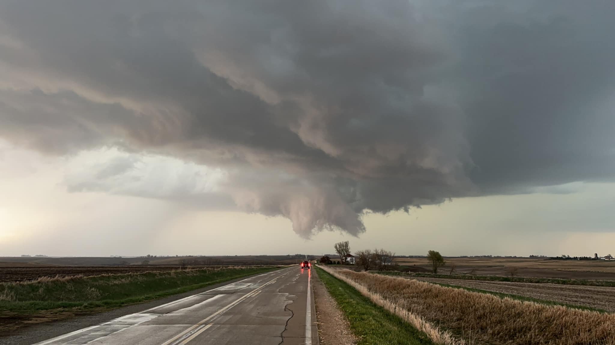
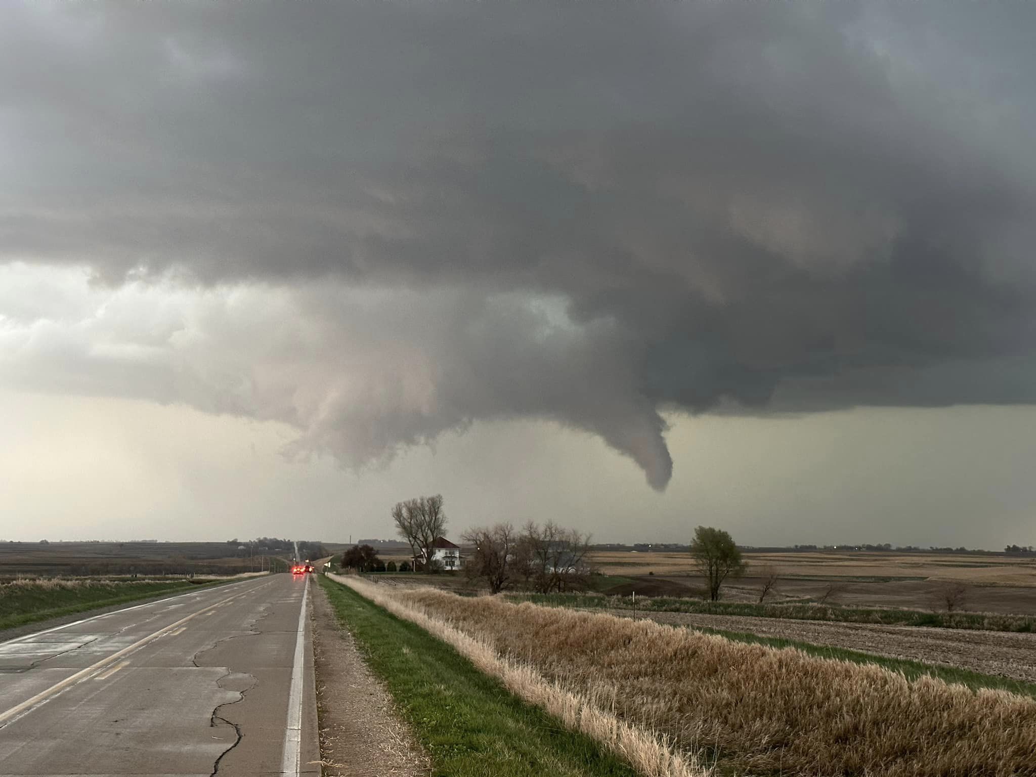
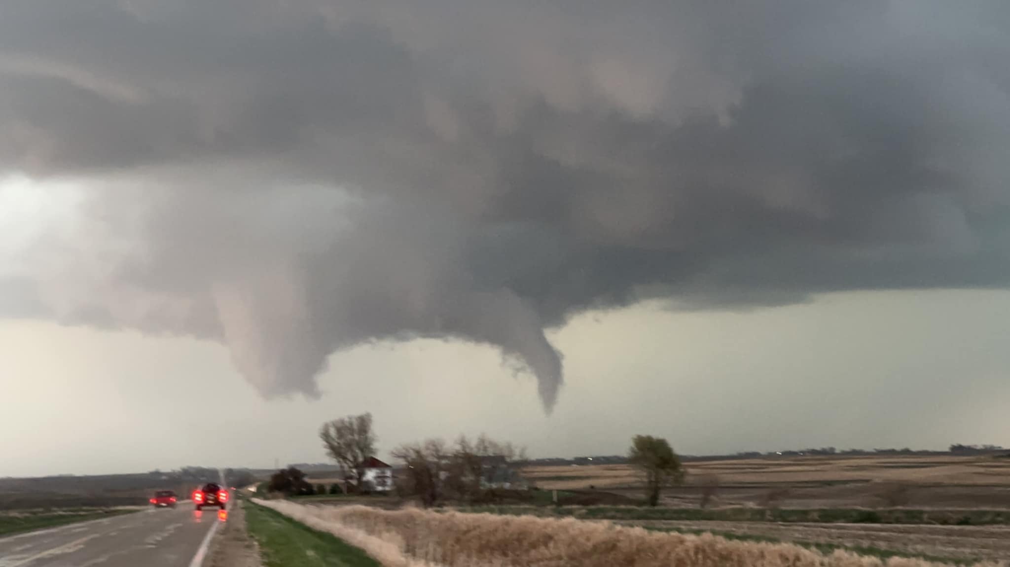
0711 PM     TORNADO          5 E MACEDONIA           41.19N 95.32W
04/19/2023                   POTTAWATTAMIE      IA   PUBLIC

0705 PM     HAIL             HAMBURG                 40.60N 95.65W
04/19/2023  E1.00 INCH       FREMONT            IA   TRAINED SPOTTER
0650 PM     HAIL             1 E HENDERSON           41.14N 95.40W
04/19/2023  E1.75 INCH       MILLS              IA   PUBLIC

            REPORT FROM MPING: GOLF BALL (1.75 IN.).
0700 PM     HAIL             UTE                     42.05N 95.70W
04/19/2023  M1.00 INCH       MONONA             IA   TRAINED SPOTTER

            TRAINED SPOTTER REPORTED QUARTER SIZED HAIL
            COVERING THE GROUND IN UTE.
0636 PM     HAIL             1 WNW EMERSON           41.02N 95.42W
04/19/2023  E2.00 INCH       MILLS              IA   PUBLIC

            PUBLIC REPORTED VIA SOCIAL MEDIA HAIL
            APPROXIMATELY 2 INCHES IN DIAMETER.
0631 PM     HAIL             MALVERN                 41.01N 95.58W
04/19/2023  U1.75 INCH       MILLS              IA   PUBLIC
0608 PM     HAIL             1 S SIDNEY              40.73N 95.65W
04/19/2023  E2.00 INCH       FREMONT            IA   PUBLIC
0628 PM     HAIL             BLENCOE                 41.93N 96.09W
04/19/2023  E1.50 INCH       MONONA             IA   BROADCAST MEDIA
0608 PM     HAIL             MINDEN                  41.47N 95.54W
04/19/2023  E2.00 INCH       POTTAWATTAMIE      IA   EMERGENCY MNGR
0610 PM     HAIL             4 S TURIN               41.96N 95.97W
04/19/2023  U1.00 INCH       MONONA             IA   PUBLIC
0613 PM     HAIL             THURMAN                 40.82N 95.75W
04/19/2023  M1.00 INCH       FREMONT            IA   TRAINED SPOTTER

            TRAINED STORM SPOTTER REPORTED QUARTER SIZE
            HAIL.

0538 PM     HAIL             GLENWOOD                41.05N 95.74W
04/19/2023  E2.00 INCH       MILLS              IA   PUBLIC
0544 PM     HAIL             4 NW SILVER CITY        41.15N 95.69W
04/19/2023  E1.00 INCH       MILLS              IA   PUBLIC
0537 PM     HAIL             GLENWOOD                41.05N 95.75W
04/19/2023  E1.25 INCH       MILLS              IA   PUBLIC
0527 PM     HAIL             3 W THURMAN             40.82N 95.80W
04/19/2023  E1.50 INCH       FREMONT            IA   PUBLIC
0529 PM     HAIL             5 NNW THURMAN           40.89N 95.79W
04/19/2023  E1.75 INCH       FREMONT            IA   TRAINED SPOTTER
0529 PM     HAIL             5 NNW THURMAN           40.89N 95.79W
04/19/2023  E1.75 INCH       FREMONT            IA   TRAINED SPOTTER