THE NATIONAL WEATHER SERVICE IN DES MOINES SAYS TORNADOES ARE POSSIBLE BY LATE AFTERNOON AND EARLY THIS EVENING IN THE KJAN LISTENING AREA.

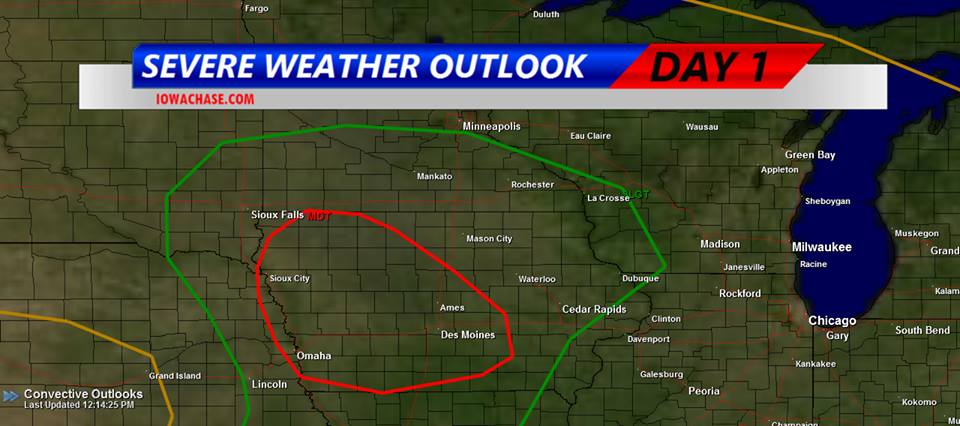
Iowa Storm Chasing Network graphic of Tornadic/Severe Storm threat.
IN THEIR HAZARDOUS WEATHER OUTLOOK ISSUED AT AROUND 12:10-P.M., THE WEATHER SERVICE SAID THERE IS A MODERATE RISK FOR SEVERE WEATHER LATE THIS AFTERNOON THROUGH THE EVENING.
ISOLATED THUNDERSTORMS ARE POSSIBLE THIS AFTERNOON WITH QUARTER SIZED HAIL AND 60 MPH WINDS POSSIBLE. MORE SIGNIFICANT SEVERE STORMS ARE THEN POSSIBLE LATER TODAY DURING THE MODERATE RISK TIME FRAME. VERY LARGE HAIL…GOLF BALL SIZED OR LARGER…70 MPH WINDS AND TORNADOES ARE ALL POSSIBLE. A STRONG TORNADO MAY OCCUR.
A moderate threat of severe weather, including tornadoes, remains in place for later this afternoon and this evening. The threat has shifted slightly to the south and west toward the Missouri River as well. Large hail, damaging winds, locally heavy rains and tornadoes are all possible. Some tornadoes may be strong and long lived.
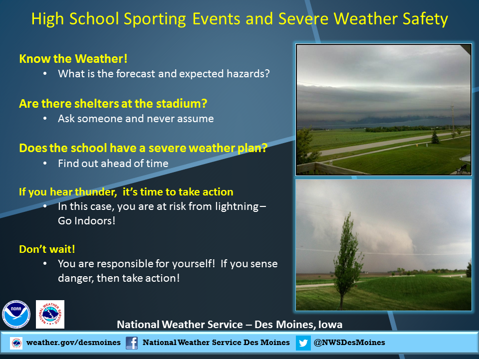
Folks with early weekend activities, including high school football games, should monitor the weather closely. Have severe weather action plans in place beforehand being ready to seek shelter on short notice.