


Forecast: More storms and heat, then a pleasant Labor Day weekend
August 29th, 2024 by Ric Hanson
(Radio Iowa) – Forecasters say Iowa should see ideal weather for the Labor Day weekend, but things may get steamy and stormy before the holiday arrives. Meteorologist Craig Cogil, at the National Weather Service, says thundershowers moved across upper Iowa this (Thursday) morning. “We’ve seen some storms develop in northern Iowa, and they’re currently moving into southern Minnesota, as we see warmer and more humid air move back into the state,” Cogil says, “and it’s certainly going to push highs up to around 90 this afternoon with the humid conditions continuing.”
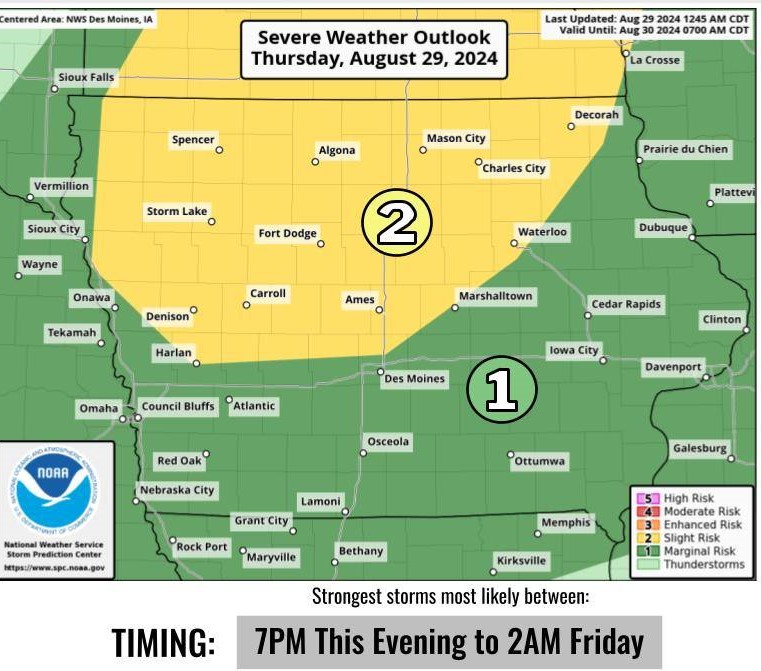
NWS graphic
Wide areas of the state may see heat indices back into triple digits today, but Cogil says another round of showers tonight should bring cooler air with it. “We’re going to see a cold front move down through the state into the overnight period, with showers and thunderstorms developing this evening,” Cogil says. “There may be the potential for some severe storms right now, looking at the main threat from damaging winds and large hail.” Once tonight’s storms are past, Cogil says it should be smooth sailing into Labor Day, as well as into next week. “It looks like the holiday weekend should be rather pleasant, particularly Sunday and Monday,” Cogil says, “with highs mainly in the 70s and very little humidity and no threat of precipitation.”
Waterloo and Davenport both set record high temperatures of 98 degrees earlier this week, with some communities seeing heat indices as high as 117.

