


Severe Thunderstorm Watch until 4-a.m. Saturday for Cass-Adair-Adams-& other counties
April 29th, 2022 by Ric Hanson
SEVERE THUNDERSTORM WATCH OUTLINE UPDATE FOR WS 161
NWS STORM PREDICTION CENTER NORMAN OK 830 PM CDT FRI APR 29 2022
SEVERE THUNDERSTORM WATCH 161 IS IN EFFECT UNTIL 400 AM CDT FOR THE FOLLOWING LOCATIONS: IOWA COUNTIES INCLUDED ARE ADAIR ADAMS CASS CLARKE DECATUR MADISON RINGGOLD TAYLOR UNION. 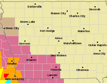
* Primary threats include…
- Scattered damaging winds and isolated significant gusts to 80
mph likely - Scattered large hail and isolated very large hail events to 2 inches in diameter possible
- A tornado or two possible
SUMMARY…A band of severe thunderstorms is expected to cross the
watch area from west-east this evening, offering severe gusts,
sporadic large hail, with a tornado also possible embedded in the
complex.
The severe thunderstorm watch area is approximately along and 50
statute miles east and west of a line from 50 miles southwest of
Knob Noster MO to 60 miles north northwest of Lamoni IA.
PRECAUTIONARY/PREPAREDNESS ACTIONS…
REMEMBER…A Severe Thunderstorm Watch means conditions are favorable for severe thunderstorms in and close to the watch area. Persons in these areas should be on the lookout for threatening weather conditions and listen for later statements and possible warnings. Severe thunderstorms can and occasionally do produce tornadoes.
