


“Major Winter Storm” to impact much of Iowa today
January 25th, 2021 by Ric Hanson
Officials with the National Weather Service in Des Moines say a major winter storm will impact much of central and southern Iowa today and tonight. Snow will increase from south to north through the day, though parts of northern Iowa may have little to no snow today. Very heavy snowfall is expected across much of Iowa along and south of Highway 30 where totals may reach 12 inches or more! The Weather Service predicts 9-to 14-inches around Atlantic, with 10-to 14-inches to the east, over parts of Adair, Dallas, Guthrie and Madison Counties.
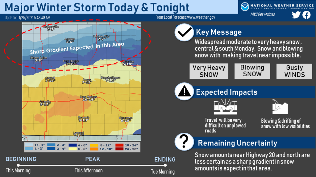 The greatest uncertainty is north of a Fort Dodge to Waterloo line and is why there are large ranges of snowfall expected in those areas. Snow amounts in Mason City, Algona and Estherville areas will likely be on the lower side of the ranges. The snow will be accompanied by brisk winds and blowing snow producing low visibilities in open areas. Travel will be difficult to near impossible on unplowed roads in the heavy snow areas, even not taking into account low visibilities and at times, whiteout conditions. This evening’s commute will be greatly impacted. Light snow will linger Tuesday morning and breezy winds will linger and will prolong the recovery time for this event.
If you must travel, keep an extra flashlight, food, and water in your vehicle in case of an emergency. If you must head out, the latest road conditions can be obtained by calling 5 1 1, and on the web (in Iowa), at 511ia.org.

